Trip history
Select a device, date mode and time range, build its stored track and interpret calculated stops and multi-day limitations correctly.

Use History on the monitoring map when you need to see where one device moved during a past day or set of days. The result is built from stored coordinates, so choose the device and dates before interpreting the line.
Select the device
Open the monitoring map and select one object in the device list. Check its name and identifier, especially when several vehicles have similar names.
History is requested for the currently selected object. Selecting several objects is useful for live monitoring, but it does not combine them into one reliable historical trip.
Select dates and time
Open the date field or track settings above the map. The current interface provides two date modes:
- Period selects consecutive dates;
- Selected dates selects separate calendar days.
For a single day you can also narrow the time interval. With several days selected, the interface can disable the time slider and some detailed display options.
You can choose up to 31 days for one construction request. This is a limit on building the current view, not a statement that data is stored for exactly 31 days. Actual availability depends on your plan, device state and service configuration.
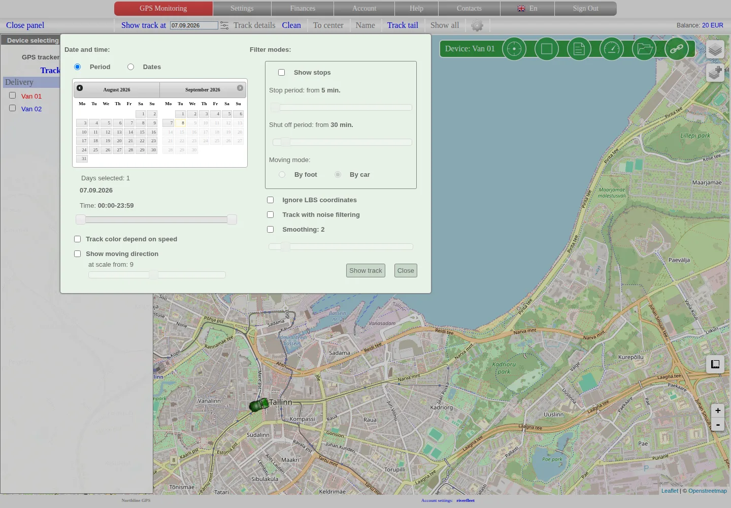
Choose consecutive dates with Period or separate days with Selected dates. Multi-day selection can disable the time range and detailed colour options.
Build the history
Confirm the selection and start the track request. Wait until the map finishes drawing before changing the object or dates.
The line joins stored points in their recorded order. It is not proof that the vehicle followed every road segment exactly. Sparse coordinates, delayed packets, positioning errors and filtering can produce long straight segments or unexpected jumps.
Standard and detailed views
For one day, the interface can provide more detailed point information and colour-related analysis. Multi-day modes intentionally reduce some detail and disable colour-by-speed options to keep the result manageable.
If you need to investigate a short incident, first build the broad interval, then repeat the request for one day or a narrower time window.
Stops
Stop detection depends on the current stop settings, point timing and movement data. A stop shown on the map is a calculated interval; it is not automatically an ignition event, delivery confirmation or timesheet entry.
Inspect part of a trip
Zoom in and select a point or segment to compare its recorded time, speed and other available values. Sensor fields appear only when the device and plan provide them. An absent field must not be treated as zero.
For an operational conclusion, compare the map with known events and device status. Export the interval if it must be retained or analysed outside the map.
If history is empty or incomplete
- confirm the object, date and time zone;
- try one day and the full-day interval;
- check whether the device and account were active at that time;
- compare the interval with the last live point and periods when the device did not communicate;
- remember that a test device can have separate history restrictions;
- contact us with the object name, identifier, exact interval and what you expected to see.
Do not delete and reconnect a tracker to repair missing history. That can make diagnosis harder and does not recreate coordinates that were never stored.
Live monitoring on the map | Analysing, exporting and deleting history
Related articles
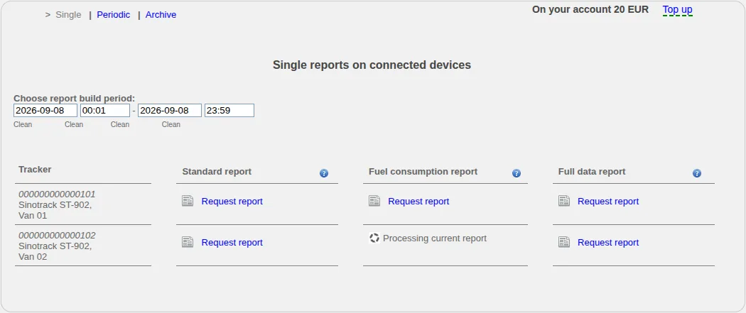
One-off and scheduled reports
Create one-off or scheduled reports, follow asynchronous processing in the archive and verify objects, periods and available fields.
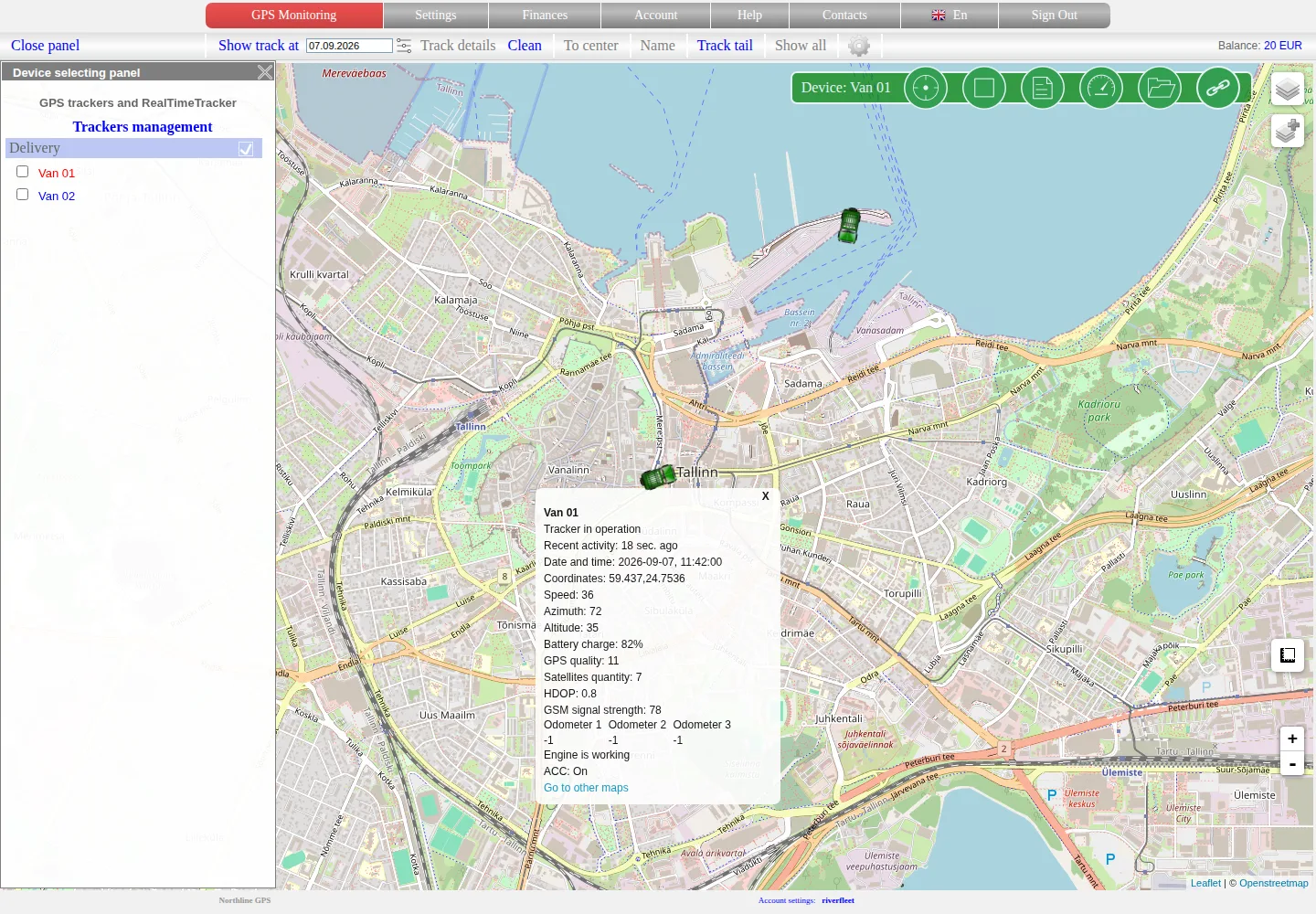
Live monitoring on the map
Select an object, read its latest data correctly and distinguish a fresh position, an old point and a tracker without coordinates.
Getting started
Choose the right first steps for an account with a tracker already connected or for a new tracker you need to connect yourself.
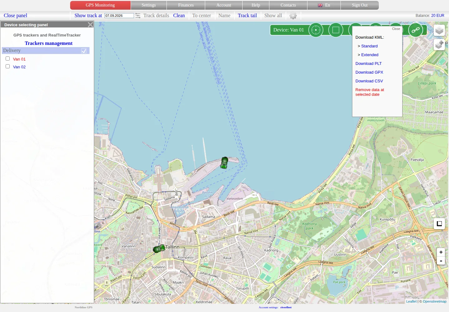
Analysing, exporting and deleting history
Replay a stored trip, compare speed and available sensor values, choose an export format and treat history deletion as a separate destructive action.
Comments
Sign in to comment.
No comments yet.