Geofences and object proximity
Configure up to four rectangular map zones, distinguish display from rule state and set supported tracker or stationary-object proximity conditions.

The service has two different geographic mechanisms: rectangular tracking zones on the map and proximity rules between two objects. They are configured in different places and solve different tasks.
Rectangular map zone
Open the map, select a device and open the alarm settings panel. Each tracker has four colour-coded zone slots. Every slot has its own state and notification channel.
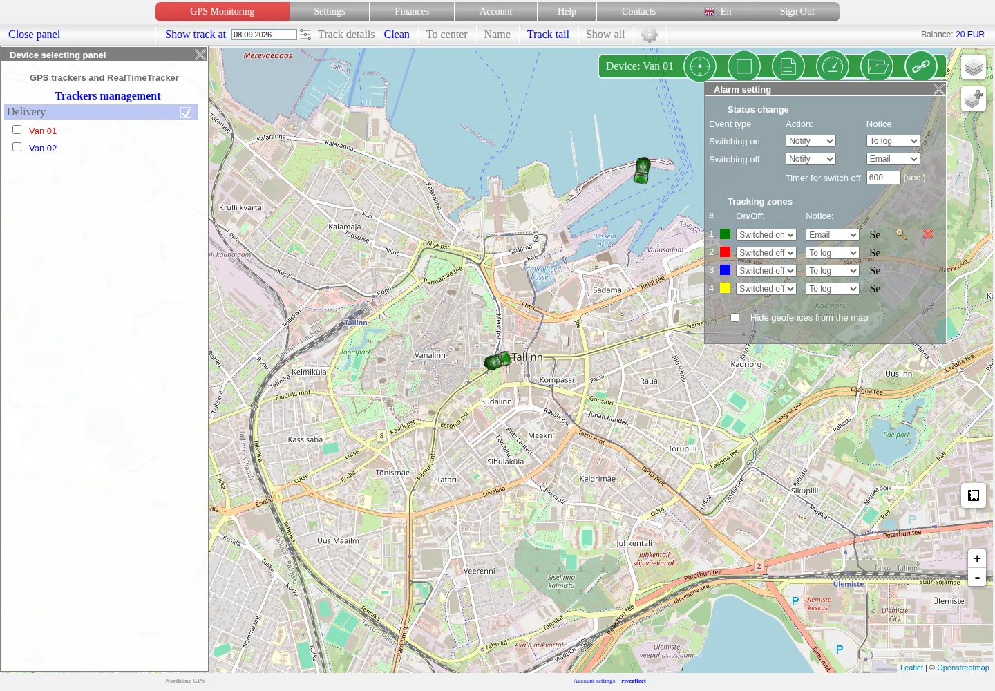
Green zone 1 is enabled and the other slots are disabled. “Hide geofences from the map” changes only rectangle visibility, not the rule state.
To create or change a shape, select the edit icon next to the required slot. A rectangle with corner handles appears on the map. Move and resize it around the required area, enter a clear name and confirm the change.
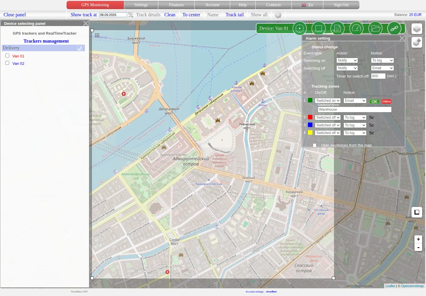
The displayed rectangle is what gets saved. Leave some margin around a gate, road or wall: normal GPS-point variation near a boundary can create repeated entries and exits.
After saving, close and reopen the editor. Check the slot number, colour, name, boundary, Enabled state and required channel.
What activation means
The service detects entry or exit from received coordinates. If no suitable points were received near the boundary, or the device was offline for a long time, the exact crossing may not appear in the log.
Check the individual history points, not only the line joining them. A log entry and email delivery are separate stages.
Hide, disable and delete
- Hide geofences from the map keeps the rules but stops drawing their rectangles.
- Disabled in a zone row stops that rule while preserving its slot.
- the delete icon removes the zone configuration.
Before deleting, verify the tracker and zone number.
Object proximity
Settings → Geofences contains a separate proximity-rule table. Select a central object, a tracked device, radius, state and notification type.
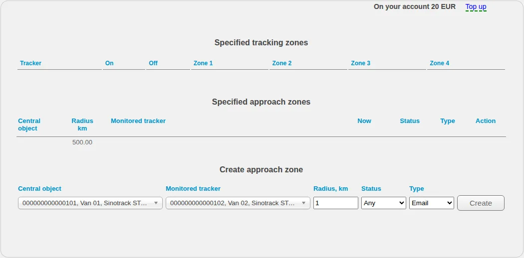
The centre can be a tracker or an available stationary object. A moving centre uses its current suitable coordinate.
Enter a numeric radius supported by the current form. Do not use the MAX option: it appears in part of the old interface but is not handled consistently by the active processing chain.
If a rule does not activate, check both positions at the relevant time, the radius, rule state, event log and delivery channel. Do not delete history or recreate the device to reset a geofence.
Related articles
GPS Operator User Guide: Contents
Connect a tracker, use the live map and trip history, create reports, configure notifications and manage your GPS Operator account.
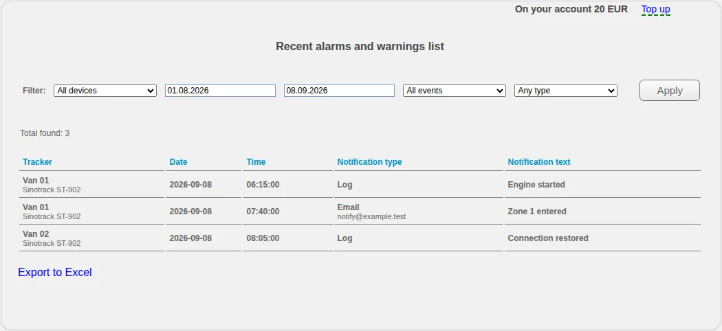
Event log
Filter recorded events by object, type and period, export the list and distinguish event recognition from notification delivery.
Comments
Sign in to comment.
No comments yet.